Boston, MA 2:1
Boston, Massacusetts – scaled down to 2:1 scale.
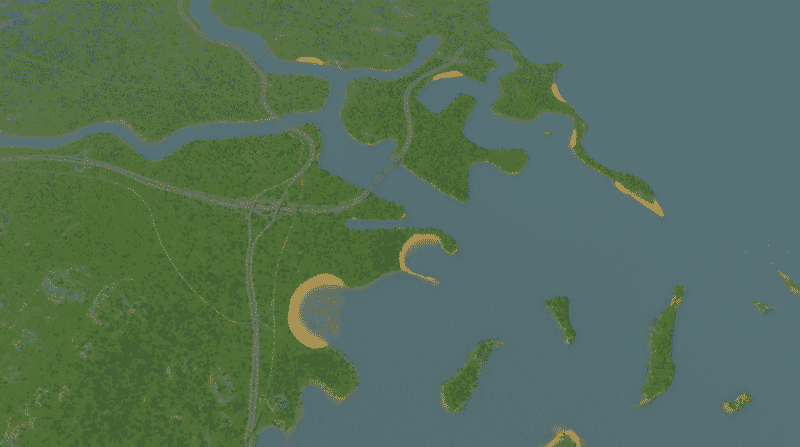
Map features accurate placement of I90 and I93, with a sunken I90 through city center Boston. I90 does not go through a tunnel towards Logan Airport as tunnels are impossible…(for now). Railways are as accurately placed as I could get them (couldn’t find accurate commuter rail info online). Charles River and Mystic River are both fully functioning, and go in the right direction! So that’s nice. Map also features accurate entry ways/exit ways for airport, assuming the airport is placed where Logan is. Map features water ways of course.
Map includes a heavy amount of forestry resource and some coal resource.
Starting location is not centered, one tile west of Boston center. This choice was made due to the river and challenges with starting water flows.
Map is designed to work with 25 tile mod.
Size Reference:
Goes as far west as Newton, as far south as Quincy, as far east as Winthrop, and as far North as Malden.
ENJOY ?


